ChamplainValley1777
Autor:
Shortlink:
Zdroj:
Formát:
632 x 1980 Pixel (656486 Bytes)
Popis:
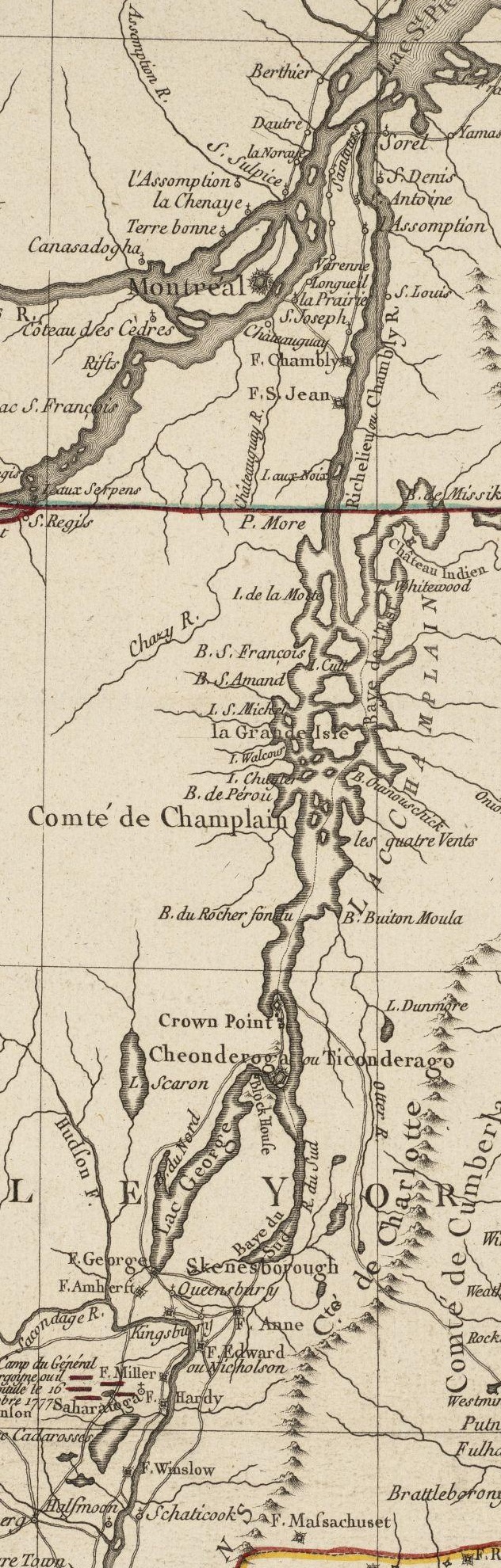
This is a detail from the source map, depicting only the Upper Hudson River Valley and the Champlain Valley as far as Montreal.
Licence:
Public domain
Credit:
Norman B. Leventhal Map Center at the Boston Public Library Call Number: G3711.S3 1777 .B75
URL at time of upload: http://maps.bpl.org/details_10101/
Sdílet obrázek:


Relevantní obrázky


Relevantní články
Pevnost TiconderogaPevnost Ticonderoga, je pevnost dříve zvaná Fort Carillon. Francouzi ji v 18. století postavili u jižního konce jezera Champlain, na severu státu New York ve Spojených státech. Název „Ticonderoga“ pochází z jazyka Indiánů kmene Irokézů: "tekontaró:ken", což znamená „na křižovatce dvou vodních cest“. .. pokračovat ve čtení