Fürstentum Regensburg 1807
Autor:
Geographisches Institut, Weimar 1807
Shortlink:
Zdroj:
Formát:
792 x 803 Pixel (521547 Bytes)
Popis:
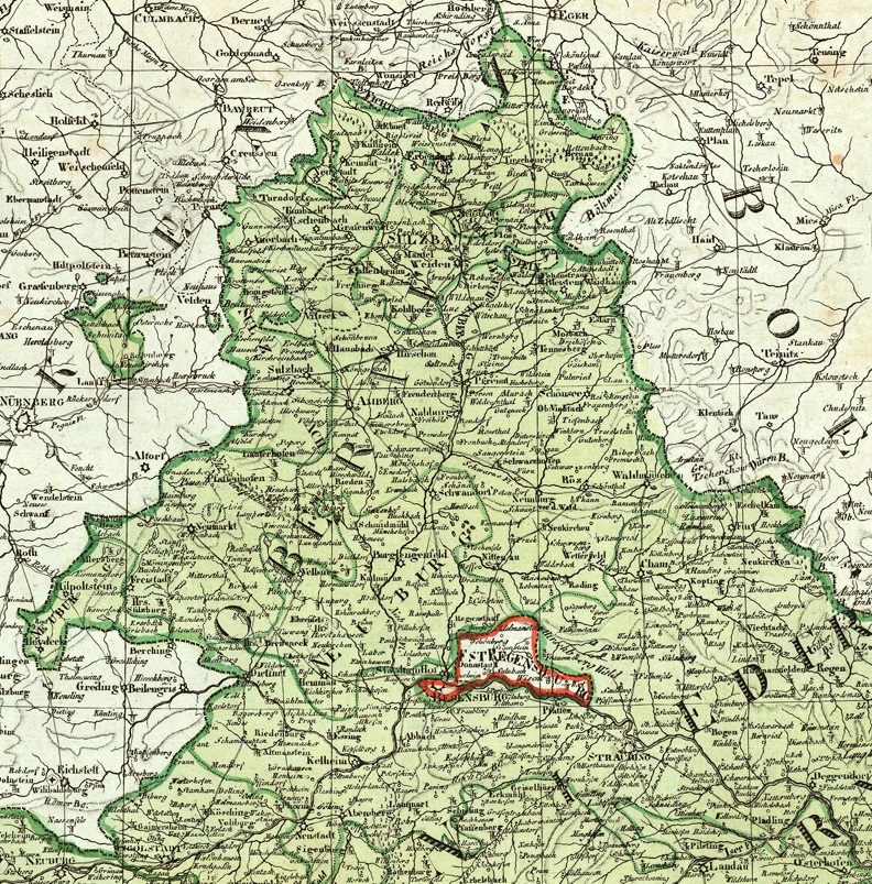
Detail of a map from 1807 showing the Principality of Regensburg (German: Fürstentum Regensburg) enclaved within the Kingdom of Bavaria (in green).
The ephemeral principality (1803 to 1810) had been formed with the territories of the former Prince-Bishopric of Regensburg and Free Imperial City of Regensburg. Cropped from a map of the Kingdom of Bavaria published in 1807 by the Geographical Institute of Weimar.
The ephemeral principality (1803 to 1810) had been formed with the territories of the former Prince-Bishopric of Regensburg and Free Imperial City of Regensburg. Cropped from a map of the Kingdom of Bavaria published in 1807 by the Geographical Institute of Weimar.
Licence:
Public domain
Credit:
Reinhold Berg (antique maps for sale)
Sdílet obrázek:


Relevantní obrázky
.svg)

.svg)


.svg)

Relevantní články
Řezenské knížectvíŘezenské knížectví byl církevní stát ve Svaté říši římské. Knížectví bylo vytvořeno v roce 1803; bylo součástí říše do jejího zániku v roce 1806 a do roku 1810 patřilo k Rýnskému spolku. Jeho hlavním městem bylo Řezno. .. pokračovat ve čtení