Frankfurt-Main Airport Map DE
Autor:
Shortlink:
Zdroj:
Formát:
2253 x 1890 Pixel (1600540 Bytes)
Popis:
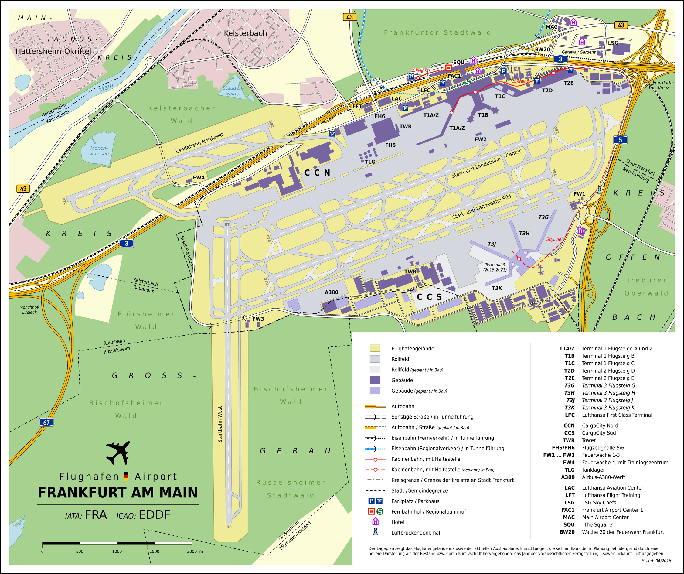
Map of Frankfurt Airport, Germany (DE)
Licence:
Credit:
Vlastní dílo
- OpenStreetMap data (map)
- Offizieller Plan B4_2-1 aus dem Planfeststellungsverfahren zum Ausbauvorhaben (2007), heruntergeladen von dieser Seite
- Information on this site
- Information collected throughout the web
- File:Airplane silhouette.svg
- File:Bundesautobahn 3 number.svg
- File:Bundesautobahn 5 number.svg
- File:Bundesautobahn 67 number.svg
- File:Bundesstraße 43 number.svg
- File:S-Bahn-Logo.svg
Sdílet obrázek:


Relevantní obrázky


Relevantní články
Letiště Frankfurt nad MohanemLetiště Frankfurt nad Mohanem je největší německé letiště. Nachází se na území velkoměsta Frankfurtu nad Mohanem. Je leteckou základnou pro společnosti AeroLogic, Condor, Lufthansa, Lufthansa CityLine, Lufthansa Cargo a Ryanair (2017). Zabírá plochu 2000 hektarů a má celkem čtyři Vzletové a přistávací dráhy. .. pokračovat ve čtení