Landsat 29may03 28m Freeport named
Autor:
Nasa, Landsat 7’s Enhanced Thematic Mapper Plus (ETM+)
Shortlink:
Zdroj:
Formát:
1273 x 3587 Pixel (858443 Bytes)
Popis:
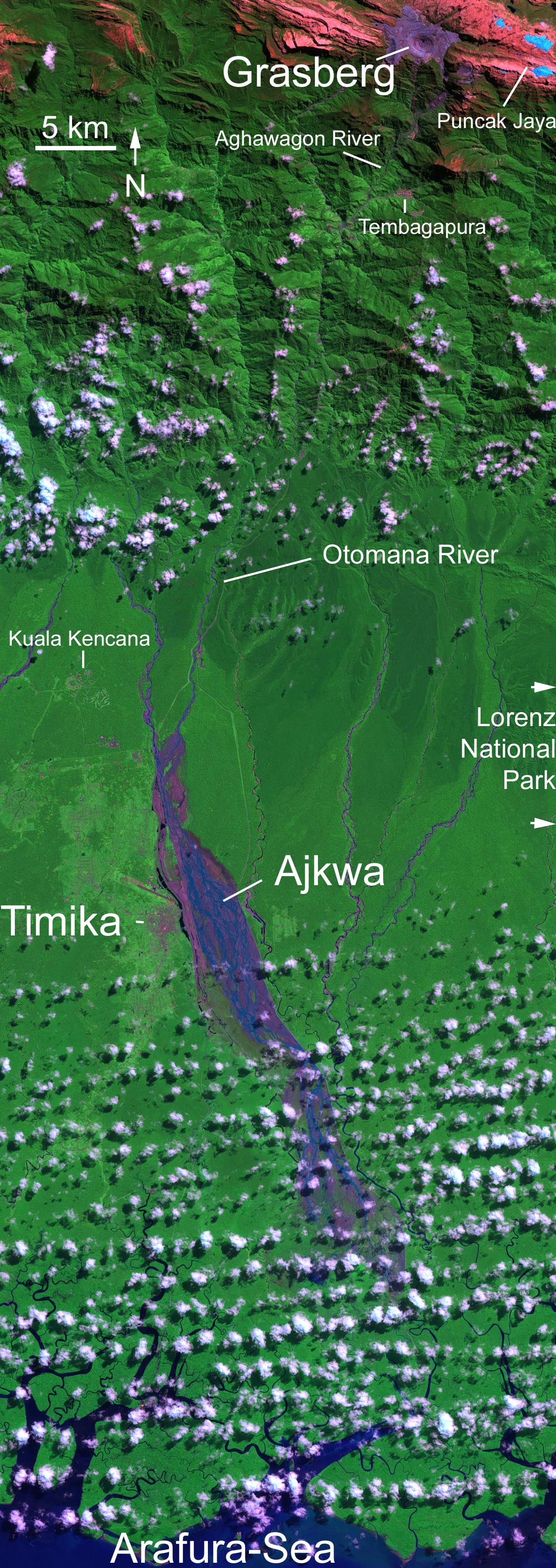
Grasberg-Mine in West New Guinea (West Papua). Ausschnitt aus dem hochaufgelösten (6000x6000 Pixel) Landsat-Original, beschriftet. Abraum der Mine in violett, hellblau: Gletscher. Falschfarbene Darstellung. Farben: snow and ice appears blue while clouds are white, bare unvegetated land such as the rocky limestone summit ridges appear red or pinkish, the deep purple and grey is the open pit copper mine while the lush rainforest of the lowlands appears green. In the large format image, runoff into the rivers south of the mine shows up in deep purple, much of which is fine debris washed downstream from the mine.
Licence:
Public domain
Sdílet obrázek:


Relevantní obrázky


(c) Alfindra Primaldhi, CC BY 2.0
Relevantní články
Důl GrasbergGrasberg je největší zlatý důl na světě a třetí největší měděný důl na světě. Leží v provincii Papua v Indonésii. Zaměstnává téměř 20 tisíc zaměstnanců. Důl vlastní z větší části těžební společnost Freeport-McMoRan se sídlem v USA. .. pokračovat ve čtení