Lituya Bay rockslide 2
Autor:
D.J. Miller, United States Geological Survey
Shortlink:
Zdroj:
Formát:
750 x 604 Pixel (112055 Bytes)
Popis:
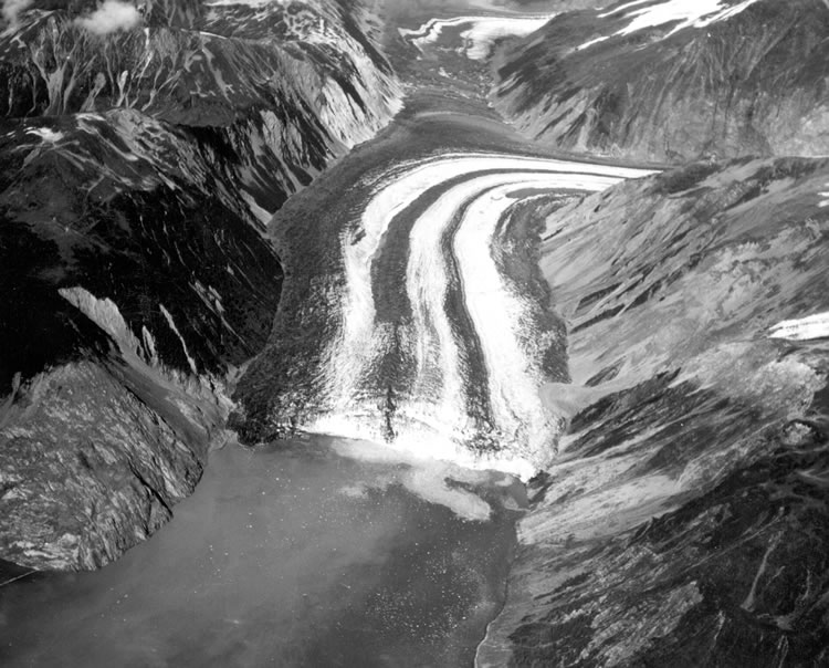
Photo looking down the Fairweather Fault Trench at the head of Lituya Bay. The front of Lituya Glacier with lateral and medial moraines is seen terminating in Gilbert Inlet. The cliff where the rockslide originated is on the right side of Gilbert Inlet. The opposite valley wall on the left side of Gilbert Inlet received the full force of the big wave, stripping it of soil and trees. Photo by D.J. Miller, United States Geological Survey.
Licence:
Public domain
Credit:
USGS via [1]
Sdílet obrázek:


Relevantní obrázky
.png)


Relevantní články
Lituya BayLituya Bay je fjord nacházející se na pobřeží Tichého oceánu v jihozápadní části Aljašky v USA. Na délku měří 14,5 km a na šířku 3,2 km. V roce 1958 v něm kvůli velkému sesuvu hornin vznikla nejvyšší zaznamenaná vlna tsunami, která dosáhla výšky 524 m. .. pokračovat ve čtení