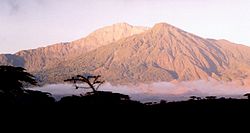
Mount Kilimanjaro Tanzania-NASA
Původně soubor načetl SeanMack na projektu Wikipedie v jazyce angličtina
Later versions were uploaded by Alureiter at en.wikipedia.Mount Kilimanjaro (Kilima Njaro or "mountain of god" in en:chagga), the highest point in Africa, reaches 5,895 meters (19,340 feet) above sea level, tall enough to maintain a permanent snow cap despite being just 330 kilometers (210 miles) south of the equator. It is the tallest free-standing mountain on the Earth's land surface, rising about 4,600 meters (15,000 feet) above the surrounding plain. Kilimanjaro is a triple volcano (has three peaks) that last erupted perhaps more than 100,000 years ago but still exudes volcanic gases. It is accompanied by about 20 other nearby volcanoes, some of which are seen to the west (left) in this view, prominently including Mount Meru, which last erupted only about a century ago. The volcanic mountain slopes are commonly fertile and support thick forests, while the much drier grasslands of the plains are home to elephants, lions, and other savanna wildlife. This 3-D perspective view was generated using topographic data from the Shuttle Radar Topography Mission (SRTM), a Landsat 7 satellite image, and a false sky. Topographic expression is vertically exaggerated two times.
Landsat has been providing visible and infrared views of the Earth since 1972. SRTM elevation data matches the 30-meter (98-foot) resolution of most Landsat images and will substantially help in analyzing the large and growing Landsat image archive, managed by the U.S. Geological Survey (USGS).
Image Credit: NASA/JPL/NIMA Larger TIFF available approx 3mb
http://photojournal.jpl.nasa.gov/catalog/PIA03355Relevantní obrázky
Relevantní články
Mount MeruMount Meru je aktivní sopka v Tanzanii. Zároveň je druhým nejvyšším vrcholem země nacházejícím se 70 km západě od nejvyššího vrcholu Afriky - Kilimandžára. Je součástí národního parku Arusha. Hora má tvar jako klasický vulkanický kužel se svahy kráteru ve formě obrovské podkovy. Na vrcholu byla v roce 2006 vztyčena dva metry vysoká, kovová vlajka Tanzanie a také milník vytvořený z betonu s nápisem „Socialistický vrchol 4562.13M“. .. pokračovat ve čtení


