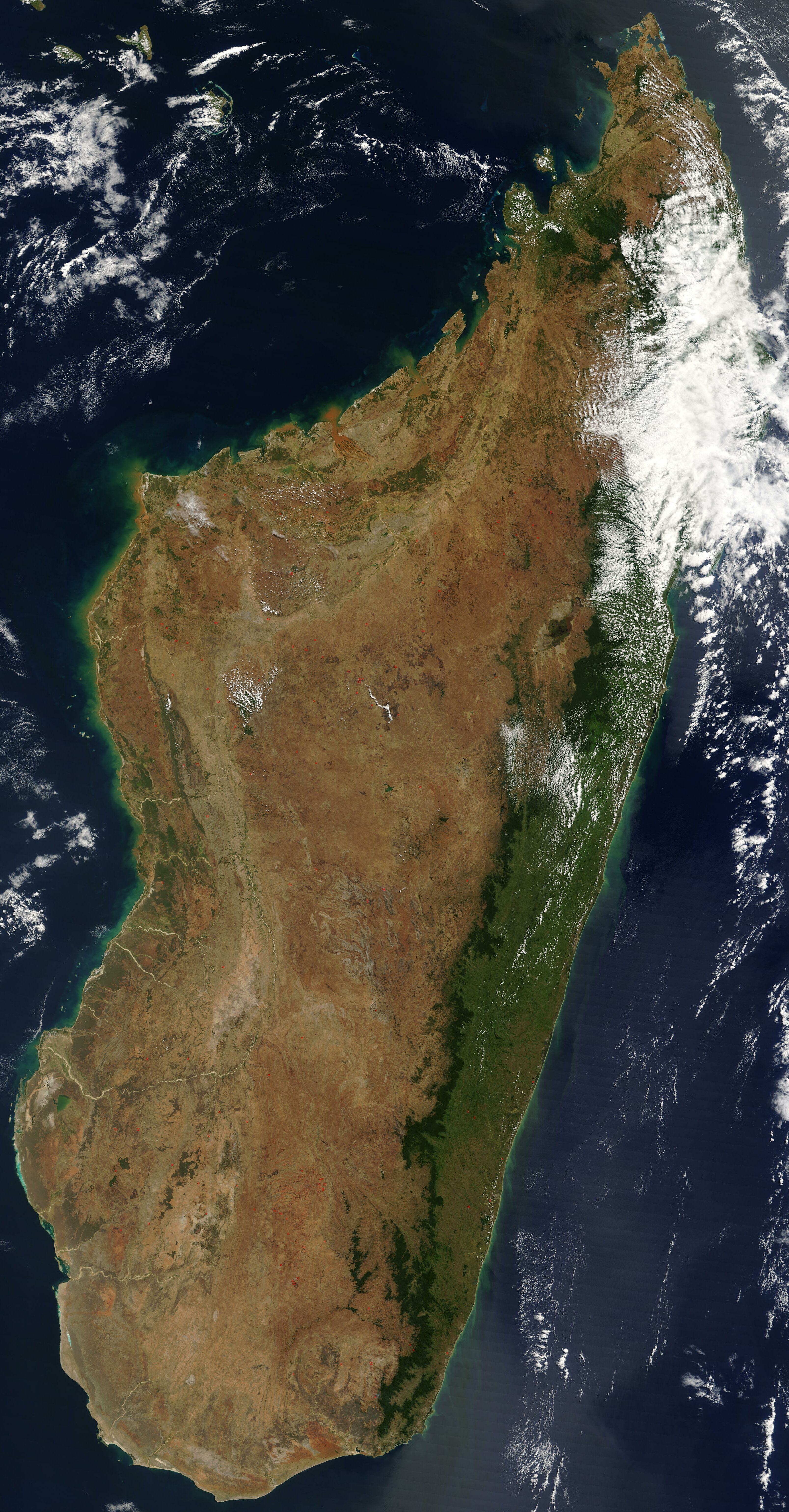
Satellite image of Madagascar in September 2003
Autor:
Neznámý
Shortlink:
Zdroj:
Formát:
3214 x 6164 Pixel (3084013 Bytes)
Popis:
Satellite image of Madagascar in September 2003. Slightly cropped, original taken from NASA's Visible Earth: [1]. Original description:
- The world's fourth largest island, Madagascar, is featured in this Moderate Resolution Imaging Spectroradiometer (MODIS) image taken by the Terra satellite on September 10, 2003. Several active fires, marked with red dots, burn in the central highlands, which are primarily covered with rice fields. The fires are probably controlled burns to clear farmland. The narrow strip of green along the east coast of the island is a rain forest. The west coast is lined with baobabs, a desert tree with a fat trunk, and thorny forest.
Licence:
Public domain
Sdílet obrázek:


Relevantní obrázky


.svg)

.svg)

.svg)


Relevantní články
Seznam největších ostrovůTento seznam řadí ostrovy světa podle jejich rozlohy. Obsahuje 50 plošně největších ostrovů světa, tedy všechny ostrovy s rozlohou nad 18 500 km². Pro porovnání jsou níže uvedeny i kontinentální masy kontinentů. .. pokračovat ve čtení