Tarso Toh
Autor:
NASA Landsat7 image (worldwind.arc.nasa.gov)
Shortlink:
Zdroj:
Formát:
640 x 458 Pixel (167735 Bytes)
Popis:
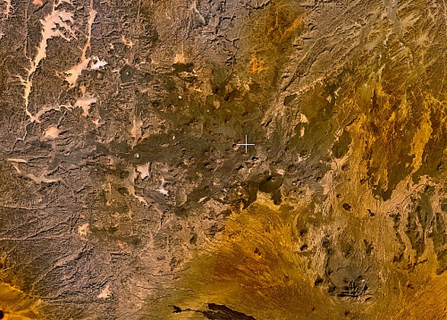
Small cinder cones and lava flows of the Tarso Tôh volcanic field can be seen in the large darker-brownish area at the center of this NASA Landsat image. This Pleistocene-to-Holocene volcanic field in the Tibesti Range of Chad covers a 30 x 80 km area and contains 150 scoria cones and two maars. Basaltic lava flows at Tarso Tôh were erupted over a basement of Precambrian schists and Paleozoic sandstones. The black lava flows at the very bottom-center are distal lava flows from Tarso Toussidé volcano.
Licence:
Public domain
Sdílet obrázek:


Relevantní obrázky


Relevantní články
Seznam sopek v AfriceToto je seznam sopek v Africe. .. pokračovat ve čtení